
 We are excited to introduce you the new release of
FDOT State Safety Office GIS Query Tool - SSOGis
We are excited to introduce you the new release of
FDOT State Safety Office GIS Query Tool - SSOGis
Release 2.0 – Date: 2/1/2022
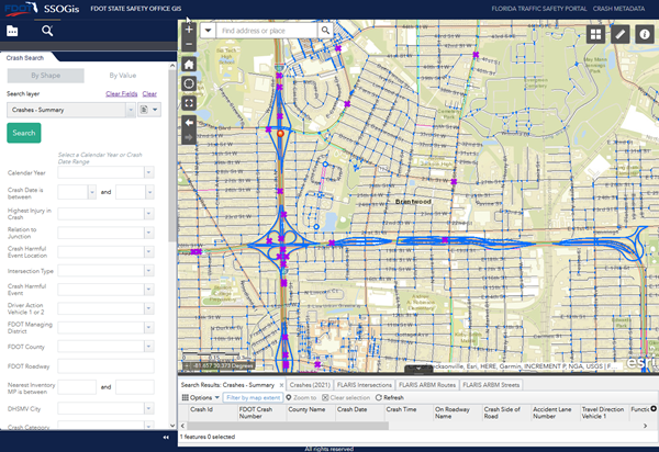
The purpose of FDOT SSOGis Query Tool is to query crash data either spatially using the “By Shape” tab and/or filter data by attributes using the “By Value” tab. Within the tool, spatial and attribute queries can be combined or performed separately.
FDOT State Safety Office (SSO) will upgrade the SSOGis Query Tool to show All Roads Crash Analysis (ARCA) and Crash Reduction Analysis System Hub (CRASH) Project locations.
The new release 2.0 of FDOT SSOGis Query Tool can be accessed on a wide range of web browsers and devices such as Microsoft Edge, Chrome, Safari, Firefox including desktops, tablets and mobile devices.
Because the tool has a public web interface and there is a need to limit the amount of data to manage performance, the tool will return a maximum of 5,000 records even when the result data set is larger.
For large dataset retrieval SSOGis GIS Services are available at FDOT State Safety Office ArcGIS Portal:
From within the FDOT State Safety Office ArcGIS Portal you can view, query, and use the following FDOT State Safety Office GIS datasets:
-
Crashes and Crash Analysis
- sso/ssogis Map Server (public) and Feature Server (FDOT)
-
Florida All Roadways, Intersections and Streets (FLARIS)
- sso/ssogis_flaris Map Server (public) and Feature Server (FDOT)
-
Additional datasets, e.g. Cities, Districts, Counties
- sso/ssogis_supplemental Map Server (public)
FDOT Open Data Hub
and the Unified Basemap Repository also display and allow export of Crashes, FLARIS and other data from SSOGIS and features other data layers pertinent for further safety analysis.
Requesting Crash History at a Specific Location:
If the above self-service mapping tools do not meet your needs for performing roadway safety analysis, you may submit a data request by email, phone, or regular mail. To request by email, please send your request to
FDOT.CrashData@dot.state.fl.us. To request by phone please call the FDOT State Safety Office Crash Records and Research Administrator at (850) 414-4007. To request by regular mail, please send requests to FDOT State Safety Office Crash Records, 605 Suwannee St, Tallahassee, FL 32399-0450, MS 53.